The SWOT swath#
From the orbit nadir ground track the software generates a grid covering the SWOT swath over 1 cycle. In the across-swath direction, the grid is defined between 10~km and 60~km off nadir. The grid size is 2 kilometers in the along-track and across-track directions by default, but can be set at any other value (e.g. 500~m or 250~m). The longitude and latitude coordinates are referenced for each grid point, and the time coordinate (between 0 and t_cycle) is referenced in the along-track direction only. A scheme of the SWOT grid is presented in Fig. 2.
The SWOT grid is stored by pass (e.g. 292 ascending passes and 292 descending passes for science orbit). A pass is defined by an orbit starting at the lowest latitude for ascending track and at the highest latitude for descending track (+/-77.6 for the SWOT orbits considered). The first pass starts at the first lowest latitude crossing in the input file, meaning that ascending passes are odd numbers and descending passes are even numbers.
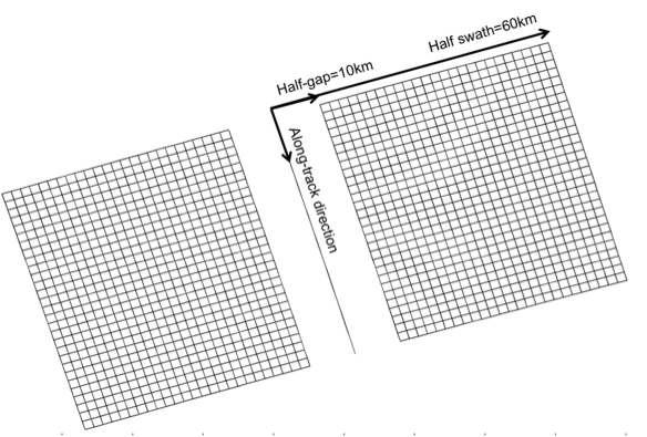
FIG. 2: scheme of the SWOT grid at 2~km resolution.#